|
Home : Quarterly Archives : Volume 26 |
Tredyffrin Easttown Historical Society |
|
Source: October 1988 Volume 26 Number 4, Pages 127–140 Where We Voted in the 18th and 19th Century In contrast to the twenty-one polling places currently established for the voters in the fifteen precincts in Tredyffrin and seven precincts in Easttown Township, for most of the 18th century, until 1785, there was just one polling place for all the voters of the two townships -- and for all of Chester County as well. It was at the court house in Chester. As the county seat of Chester County, it was the place for all the official business of the county, including voting in elections. Before 1724, the court house was on the west side of Front Street [now Edgemont Avenue] in Chester, about 150 feet north of 38-Foot Street [now Second Street] and 259 1/2 feet from the southwest corner of Front Street and James Street [now Third Street]. It was built in 1695 by John Hoskinson a lot purchased from him by the County Commissioners for £8. (This was actually the second court house; it had replaced an earlier one that had been built in 1684-85 on the east side of Front Street, almost opposite but slightly to the south of the new court house building.) The 1695 court house was a two-story building. The first floor was also used as the county jail until a new jail house was erected "in the country" -- about two blocks to the north and one to the west of the courthouse.
1724 Court House in Chester By 1723 this court house was no longer large enough to accommodate all the business of the growing county. After much local agitation, the Pennsylvania Assembly in that year authorized 300 to build a new courthouse, to be located out by the jail, on the west side of High Street [later Market Street and now the Avenue of the States]. It was about a block and a half north of the Market Square, and between Work Street [now Fourth Street] and Free Street [now Fifth Street]. The new court house was also a two-story building. Its first floor was 13 1/2 feet high and the second floor had 8 1/2-feet ceilings. It was made of sandstone, the outside stone walls two feet thick. Its final cost was 1200 "Lion" or "Dog" dollars, apparently the local currency at that time: whether it was within budget appears not to be reported. Completed in the fall of 1724, it too served as the polling place for all of Chester County. (The building, incidentally, is still standing, and is said to be "the oldest public building in the United States". It was described by Dr. Sylvester Stevens, in his Pennsylvania: Birthplace of a Nation, as representative of "some of the best architecture anywhere in the British Empire of the time".) Although in 1739 Chester County was divided into eight election districts for the purpose of designating inspectors at the general elections, the polling place for general elections for the whole county remained at the Court House in Chester for another forty-six years, until 1785. To be eligible to vote, Futhey and Cope reported in their History of Chester County, a citizen was "required to own fifty acres of land, well seated, with twelve thereof cleared and improved, or otherwise be worth fifty pounds in money". The general election was held on the 1st of October, with the polls open for six hours, from nine o'clock in the morning until three o'clock in the afternoon. For many voters, including those of Tredyffrin and Easttown, to go to the court house at Chester was a long way to travel by horseback or horse and carriage. And frequently the large gatherings in the county seat on the day of the election led to considerable confusion and disturbance and disorder. To improve the situation, in 1785 the eight election districts were consolidated into four. Each district now also had its own polling place, located (except in the First District) near to the center of the district.
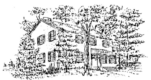
The Inn at Yellow Springs Easttown was put into the new First District, with Birmingham and Thornbury townships and all of the present Delaware County. The polling place for the district was still at the court house in Chester. At the same time, Tredyffrin was placed in the Fourth District, which encompassed the northern part of the county, and also included Willistown, Charlestown, East Whiteland, Goshen, Westtown, Uwchlan, Pikeland, East Nantmeal, Vincent, and Coventry townships. The polling place for this district was at the Inn at Yellow Springs. (In the latter part of the 18th century and into the 19th century, an inn was more than just a place for rest and refreshment: taverns were also used by various organizations for social functions, as meeting places, for political rallies, obviously as polling places, and, in the 1800s, as post offices.) The Inn at Yellow Springs had been opened thirty-five years earlier. In 1750, Robert Pritchard petitioned successfully for a tavern license as there was at Yellow Springs "frequently a Great Concourse of people on account of Health and also many others Traveling about their Occasions on a Publick Road laid out and Opened Near the same". The innkeeper at the time it became a polling place in 1785 was Alexander McCaraher, who had been a surgeon at Yellow Springs during the Revolutionary War. He took over as innkeeper in 1783, and continued as the inn's host until his death in 1787. By that time, however, the Inn at Yellow Springs was no longer a polling place. For despite this redistricting, throughout the county there was still considerable inconvenience and dissatisfaction and complaint by some of the voters. Thus, in the fall of 1786, the county's election districts were again reorganized by the Assembly. As a result, new polling places were established for the voters of both Tredyffrin and Easttown. The reconstituted First District still included Easttown township, but was now made up of townships generally to the south and southwest, including Willistown, Goshen, Westtown, East and West Bradford, Thornbury, Birmingham, Kennet, Pennsbury, Newlin, East Fallowfield, Edgemont, Concord, and Bethel townships. (The other townships in what is now Delaware County, with which Easttown had previously been placed as the First District, were now in the new Fourth District.)
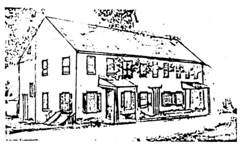
The new Court House "near the Turk's Head" With the completion of a new county court house "near the Turk's Head" tavern in Goshen Township [in what soon became, and is now, West Chester], it became the polling place for this new First District. It was located on the west side of High Street, on a lot seven perches by ten perches, its southeast corner three and a half perches, or about 56 feet, north of the intersection of High Street with South Street [now Market Street]. The site of the new building "near the Turk's Head" was actually almost directly across the street from the tavern, which was on the northeast corner of the intersection of the two streets. The court house was a two-story building, apparently of frame construction on a stone foundation, with a gable roof. From its center rose a steeple with the town clock, though the copper ball and weathervane at the top were not added until five years later, in 1791. (The cost of making the "vain", incidentally, was one pound ten shillings.) The design of the court house, and of the jail behind it, were described by Futhey and Cope as "miserable specimens of architecture", with "those who planned them seeming to have no conception of such a thing as architectural symmetry or beauty"! At the same time, in 1786, Tredyffrin became a part of the new Second District, again with the northern townships of the county, including East and West Whiteland, Charlestown, Uwchlan, Pikeland, East and West Nantmeal, East and West Cain, Vincent, and Coventry townships. The polling place for this district was established at the "Sign of the Red Lion, in the township of Uwchlan", and it was to there that Tredyffrin's voters traveled to vote for the next eleven years. The "Red Lion" was located about four miles north of Downingtown, "on the road leading from Philadelphia to Lancaster through Conestoga". It was one of the oldest inns in Chester County, the petition of a James Pugh for a license to dispense spirits having first been "allowed" in 1727; in the petition for the license it was pointed out that "several of us subscribers having our residence fifty miles and upward distance from Chester and [that there was] no house of publick entertainment in all ye space or distance". The inn was not called the "Red Lion" until 1750, but thereafter was known as the "Red Lion" or ''Red Lyon", the village of Lionville later taking its name from the hostelry. The tavern itself was a two-story stone structure, in 1786, when it became a polling place, Dennis Whelen was the innkeeper. Later innkeepers while it was the polling place for Tredyffrin were Reuben Lewis, Martin Holman, Elisha Evans, and John Wagonseler.
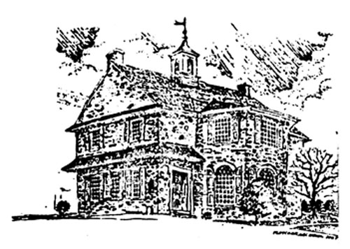
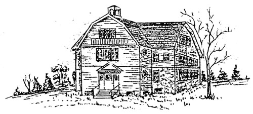
The "Red Lion" in Uwchlan When Delaware County was created in 1789, the entire Fourth District, as well as three townships and parts of two others in the First District, were no longer in Chester County. With this change, there were now three election districts in Chester County, each containing twelve townships. (At that time there were only thirty-six townships in the county.) While the districts were officially designated, as before, as the First, Second, and Third Districts, they were more commonly known as the "West Chester", "Red Lion", and "Chatham" districts, from their polling places. These election districts continued without modification until 1797. In that year the Assembly reduced the size of each district by creating four additional election districts, dividing the county into seven districts altogether. The new Seventh District included five townships--two from the old First District, Easttown and Willistown, and three from the eastern part of the old Second District, Tredyffrin, Charlestown (which then also included Schuylkill township and the Borough of Phoenixville), and East Whiteland townships. The polling place for the new district was "at the house now occupied by Richard Robinson, in Tredyffrin", also known as the "Paoli". It obviously was much closer to home and more convenient for the voters of both Tredyffrin and Easttown townships. The "Paoli" had opened as a public house in 1769, when Joshua Evans' petition for a tavern license was "allowed". In his petition he noted that on the road then passing from Chester to the upper part of the county there was "no house of public entertainment between Yellow Springs and the Square in Newtown", a distance of some fourteen miles, and, further, that his "very commodious house", located at the intersection of that road with the road between Lancaster and Philadelphia would enable a public house at that place to be "of great use not only to those passing to Chester and Darby, but also to travelers going and coming that way from Philadelphia, &c. &c". (Anthony Wayne, incidentally, was one of the signers of the petition.)
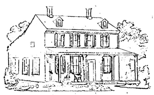
The "Paoli" Evans "very commodious house" was actually, according to Julius Sasche, "a small unpretentious two-story affair, with small windows and low ceilings". He estimated its size originally to have been about 42 feet by 30 feet; by 1797, however, a 27 feet by 30 feet addition of local limestone, or blue marble, had been added. Even though the Turnpike was then the major road at the intersection, the inn still faced on the "valley" Road. [It was located about where the Paoli post office now stands.] Richard Robinson took over as innkeeper of the "Paoli" (also at various times called the "General Paoli") in about 1782, and continued as its host until 1806. For the next forty years after that Joshua Evans Jr. was the innkeeper. (Evans was also the first postmaster of the Paoli post office from 1826 to 1830 -- the "Paoli" served as the post office as well as as the polling place -- and was a representative in the United States Congress from 1828 to 1832.) "It was not an uncommon occurrence," Sasche reported, "for over five hundred persons to be in and about the inn on an election day, while on the day of a grand 'Democratic Rally' the horses and vehicles could be counted by the hundreds and attendees by the thousands." While the "Paoli" was used as the polling place for the Seventh District until 1841, as the population of the area continued to grow over the years, parts of the district were split off into new election districts. Thus, in 1823 Charlestown Township became the Twentieth District, its polling place "at the house of Robert Boyle, innkeeper"; in 1838 East Whiteland Township became the Thirty-Second District, its polls "at the house known by the name of the General Wayne in said township"; and in 1839 Willistown Township became the Thirty-Fifth District, with its polling place "at the house now occupied by Jacob Kimes in Sugartown". The Seventh District now included only Tredyffrin and Easttown townships. In the following year Easttown Township also became a separate election district, the Thirty-Ninth. Its polling place was established "at the house of Philip Kirk, sign of the Leopard".
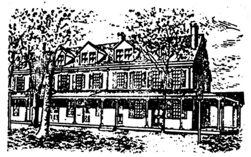
The "Leopard" The inn had been opened in 1785 when John Phillips was granted a license to operate a tavern at the intersection of Darby and Leopard roads. (In the petition of John Evans in 1801, this location was described as "on the road leading from the Turnpike to Chester, Darby and Philadelphia, and also another road much frequented, crossing at this house, leading to Grubb's Mill and county of Delaware". The inn was located at the northwest corner of the intersection.) By 1793 Evans was the innkeeper, and in 1799 he named it the "Leopard". It was also from time to time known as the "Sign of the Leopard" or as the "Leopard Inn", and from the name of the inn the village around it also took its name. The polls for Easttown Township were located at the "Leopard" until 1872, though in the official election returns it was identified by the name of the innkeeper rather than the name of the inn: at "the house of Philip Kirk", for example, from 1841 to 1843; "the house of Isaac Thomas" from 1844 to 1851; "the house of George Hippie" from 1852 to 1854; "the house of Israel Home" from 1855 to 1862; "the house of William Steele" in 1863 and 1864; and, in 1865, as "the house of Isaac Thomas, dec'd.". By this time the building was no longer a public house or inn, but had been converted into a general store. Nonetheless, in 1867 it was identified as "at the house of Hayman & Downing" in the official returns for 1867, and, finally, as "the house of John W. Hayman" beginning in 1868. (In addition to being the storekeeper, Hayman was also the first postmaster when the Leopard post office, located in the store, was opened in 1866.) When Easttown Township was set up as a separate election district in 1840, it also meant that Tredyffrin Township was now a separate election district. The polls remained at the "Paoli" that year (in the official returns for the previous year it had been described by the judges and inspectors of elections as "at the usual place"), but in 1841 they were moved to "at the house of Charles Thompson". He was the innkeeper of the "Washington Inn", "situate at the Crossroads in Howellville". For the elections in 1842 the polls were again moved, to Centerville, but in 1843 they were returned to the "Washington Inn", by then "the house of John S. Workheiser", for one more year. The "Washington Inn" was also an old tavern, opened in 1745. It was not until 1799, however, that it first took as its name the "General Washington". The license in 1745 was granted to a Joseph Mitchell, who was the innkeeper for almost twenty years, through 1763. In 1765 David Howell took over the house ("lately kept by Jonathan Gilbert" in the intervening year), and, except for the four years from 1786 to 1790, it was kept by a member of the Howell family for more than three decades. In 1770 it was called the "Sign of George the Third", changed in 1786 to the "Sign of George the Second". More generally, however, it was known for many years as "Howell's Tavern", "Howell's Old Stand", or simply as "Howell's". The village of Howellville obviously derived its name from the Howell family that were the innkeepers.
The "Washington Inn" at Howellville The inn itself was a large two-story building, at the intersection of the Swedes Ford Road and the "road leading from the Turnpike" [now Bear Hill Road]. As noted earlier, in 1842 the polls for Tredyffrin were moved to Centerville, "at the house of Jacob Knouse". After their return in 1843 to Howellville for one year, in 1844 they were returned to the hotel at Centerville, by then "the house of Evans Kendall", where they remained for more than forty-five years. The hotel at Centerville had opened in 1812 [when Samuel Barry received a license "to sell liquor in small measure"] as the "Cross Keys". It was located "on the road leading from Philadelphia and Lancaster Turnpike to the Valley Forge, commonly known as the Baptist Road [now Valley Forge Road], at the intersection of the road leading from Swedesford toward the Borough of West Chester". In 1836 it was called the "Sign of the Farmers & Mechanics Hotel", the name by which it was known when it became the polling place for Tredyffrin Township. The polls remained "at the house of Evans Kendall" until his death in 1886, after which his son, George W. Kendall, succeeded him as the innkeeper. During the time that Evans Kendall ran the hotel, its name was changed several times but it perennially appeared on the official returns as "at the house of Evans Kendall". In 1856 the name was changed from the "Sign of the Farmers and Mechanics Hotel" to the "Centerville House", and in 1860 to the "Centerville Hotel". In 1872, with the change in the name of the post office from Centerville to New Centreville, the hotel similarly became the "New Centreville Hotel". It was also known locally as "Kendall's Hotel". (In addition to serving as the polling place, the hotel was also used for the post office from 1857 to 1875, with Evans Kendall the first postmaster.)
Leopard School Although the polling place for Tredyffrin remained at the hotel at Centervilie/New Centreville for almost half a century, an attempt was made in 1857 to move it back to Howellville again. In a petition to the judges of the Court of Quarter Sessions for Chester County, ninety-five citizens of Tredyffrin Township "respectfully represented" that "the place at which the elections [are held] in said township is not central and is inconvenient to a large number of inhabitants" and, further, that "Howelltown is located much nearer the centre of said township and a large number of the votable inhabitants of said township desire the place of holding elections in said township changed from Centerville where it is now held to Howelltown Hotel aforesaid". They therefore requested that the Court order an election on "the question of the change of the place of holding the general, special, and township election .... as provided by law". There quest was approved by the court, but in the special election held on the question in June of that year the proposed change in the polling place was defeated, with 66 votes for "Evan Kendall's house, Centerville" and 57 votes for "George Steitler's house, Howellville". A petition by "a number of voters" in Easttown Township for a change in the polling place of that township in 1872 met with better success. In this instance, "one-third of the qualified electors of the election district comprised of the township of East Town" respectfully represented that "the convenience of the voters of said district would be promoted by the change of the place of holding the general, special and township elections of said district from the Leopard Tavern (now discontinued as a public house) to the Leopard School House". In the special election held pursuant to this petition the change, a move of a distance of about 200 yards, was approved, and in that year the school house at Leopard became the polling place for Easttown Township. The Leopard School at that time was a two-story structure, with the second floor used for church services, Sunday School classes, township meetings, and other gatherings, as well as for the polls. It had been built in 1854 on a lot on the north side of Leopard Road, about 250 yards east of the road's intersection with the Darby Road [now Darby-Paoli Road]. In October 1882 the school was replaced with a one-story, one-room building of brown stone -- the specifications for the building called for "good building stone except serpentine" -- "bedded in good mortar composed of clean sharp sand". Built by H. Morgan Ruth, it was 48 feet long and 22 feet wide, with walls 20 inches thick. A porch ran along the full width of one side of the building.
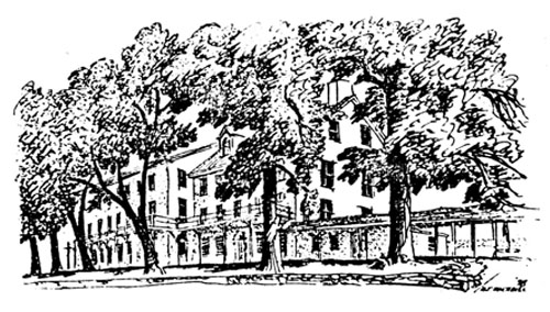
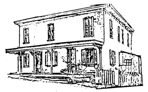
The Public Hall in Berwyn The Leopard School continued as the polling place for Easttown Township until 1888. With the growth of the Berwyn and Devon areas of the township in the preceding decade, in March of that year another petition was presented to the Court of Quarter Sessions, in which it was represented that "the convenience of the voters ... would be promoted by the change in the place of holding the general, special and Township elections ...from the public school house at Leopard, where said elections are now held to the Public Hall at Berwyn". The requested election "on the question of the change" was held on June 19, with the proposed change approved by a vote of 111 to 15. Accordingly, on July 2d the Public Hall became the polling place for the voters of Easttown Township. The Hall in Berwyn was located on the west side of Church Avenue [now Main Avenue] between Berwyn and First avenues. It was a two-story frame building, 40 feet long and 26 feet wide, and had been built ten years earlier, in 1878, by the Berwyn Hall and Library Association. (The Association had been incorporated in May 1878; its purpose was "the erection of a hall for private use, and the maintenance of a public library". Over the years the Hall was also used for a lyceum, church services, sociables, and other entertainment.) During the 1880s, partly as a result of the promotion by the Pennsylvania Railroad of suburban living along the Main Line, there was a marked growth in the population of both Tredyffrin and Easttown townships. During this decade the population of Easttown Township practically doubled, from 845in the 1880 Census to 1682 in the 1890 Census, while in Tredyffrin the population increased from 1975 to 2549. As a result, in May 1890, petition was made to the judges of the Court of Quarter Sessions by fifty-eight "freeholders, electors and residents in the Township of Tredyffrin" to divide the township into two election districts "of compact and contiguous territory". In support of their petition, they noted "the large extent of the said township", that "at the last presidential election more than five hundred votes were polled at the single voting place in said Township", and that "there are between six and seven hundred votable: in said Township ... [who] labor under great inconvenience for want of a division of the said Township into two election districts". Under the new procedures enacted by the Assembly in 1876 and 1888, the Court, in response to the petition, appointed three "impartial" commissioners (Edward H. Hall, Esau Loomis, and William P. Marshall) to "inquire into the propriety of granting the prayer of the petition".
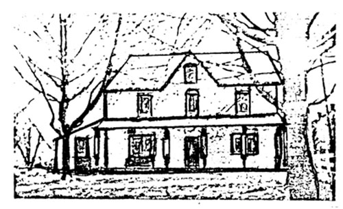
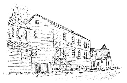
Strafford School After "having heard the proofs of the number of voters in the said Township and their distribution in the Township, as well as the opinions of the voters who attended the [special public] meeting" held at the railroad station in Devon, the Commissioners reported in August that they were "unaminously of the opinion that the prayer should be granted and that the convenience of the electors and the public interests would be promoted by dividing the Township of Tredyffrin into two election districts". They also recommended that the line dividing the two districts be the center of Valley Forge Road, running north and south through the entire width of the township, from the Montgomery County line to the Delaware County line. The recommendations were confirmed by the Court that November. The Court also decreed that the place of holding elections in the Eastern District was to be "at the public school house known as the Strafford School", with "the Store of John Beidler in the village of Howellville" the polling place for the Western District. The Strafford School had been built the previous year, in 1889. It replaced an earlier one-room school that had been built in 1872 on the same site (known as the Eagle School after the closing of the old Eagle School) that had been destroyed by fire. The school was located on the north side of Upper Gulph Road near "Pechin Corner" [the intersection of Upper Gulph and West Valley roads]. The building was originally a one-story structure, with two classrooms, 23 feet by 29 feet, but a second story, also containing two classrooms, was soon added. A gambrel roof also provided attic space over the second floor. The "Store of John Beidler in the village of Howellville" was situated on the east side of the Howellville-Newtown Road [now Howellville Road], the southernmost of the four buildings on that side of the road in the village. The building was two stories high. A general store occupied the ground floor, while the upper floor was used as the Odd Fellows' Hall. (The store also served as the Chester Valley post office from 1857 to 1893.) John Beidler Jr. had become the storekeeper, and also the postmaster, the previous year.
The "Store of John Beidler" in Howellville In late 1891 "sundry inhabitants of the Township of Tredyffrin" filed two petitions in the Court of Quarter Sessions requesting that a change be made in the line dividing the two precincts or districts. In the first, filed in October, a dividing line running from east to west, rather than north and south, was proposed, to begin at the intersection of Pugh Road and County Line Road and run west along Pugh Road to Valley Forge Road, then north to the Trenton Cut-Off, and then west, parallel to the Trenton Cut-Off to the township line. In the second petition, filed two months later, the petitioners noted that their October petition was, in fact, based on an "incorrect understanding of the topography of the Country", and proposed a new north-south dividing line, running through Howellville and thus west of the line established in 1890, the line to start at the dam at Valley Forge and run along Yellow Springs Road to what is now Mill Road, north on Mill Road to Swedesford Road, west on Swedesford Road to Howellville, and then up what is now Bear Hill Road to the township line. Both petitions were reviewed by the three court-appointed Commissioners (in this case, William P. Marshall, Thomas Mercer, and John P. Mullen), who also held public hearings at the Paoli and Devon railroad stations. In each case, the Commissioners were "of the opinion that it is not expedient to divide the said township in the manner prayed for" in the petitions. Their reports were confirmed nisi by the court in January 1892, and the precincts or districts remained unchanged. In the fall of 1892, however, another petition concerning the election districts in Tredyffrin was filed and heard by the court. Following its review and hearing, the court announced that its was "of the opinion that the convenience of the electors and the public interests would be promoted by the division of Tredyffrin into three election districts" and ordered and decreed that it. be so divided. The boundary line between the west and middle precincts started at the Schuylkill-Tredyffrin township line on the Phoenixville Road and ran southwest to Yellow Springs Road at the Diamond Rock School, then east along Yellow Springs Road to the road that ran "from Restorer Lamb's land' south to Swedesford Road about 100 yards east of Howellville Road [the old Mill Road], then east along Swedesford Road "to a point where it crosses the Chester Valley Railroad", and thence south on Cassatt Road (one of the early Telford roads in the area and described as "Cassatt's Turnpike") to the Easttown Township line. The line dividing the east precinct from the middle precinct ran west along Pugh "Avenue" from the Montgomery County line to the "Baptist Meeting Road, otherwise known as Valley Forge Road", and then south along that road to the Delaware County line.
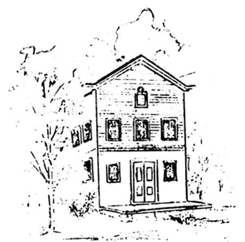
The Odd Fellows' Hall in Berwyn [p. 14] The polling place for the new western district remained "at the store of John Beidler, in the village of Howellville". For the middle precinct, the place of holding elections was returned to New Centreville and the "New Centreville Hotel", now "the house of George Kendall", as it was described in some of the election returns in succeeding years. And in the new eastern district, the polls were "at Strafford Hall" as the second floor of the Strafford School was then known. At the same time, a number of electors in Easttown Township also successfully petitioned the court to divide Easttown into two election districts. The dividing line between the two districts, as decreed by the court in October 1892, ran from the point where the Lancaster Pike crossed the township line (a few yards west of Waterloo Avenue in Berwyn), south on Waterloo Avenue to "an avenue at the corner of T. Aiken's land" [Berwyn Avenue], west to Bridge Street, south "one square" [to First Avenue], then "one square east" back to Waterloo Avenue, south on Waterloo Avenue to Sugartown Road, west to Newtown Road, and then south on Newtown Road to the Delaware County line. The place of holding the election in the eastern precinct continued "at Berwyn Hall, Church Avenue", while the polling place for the western precinct was established "at Trego's Hall, Waterloo Avenue". Trego's Hall was owned by P. J. Trego, a stove dealer (and later also the leader of the Berwyn Cornet Band). It was located on the southwest corner of Waterloo Avenue and the Lancaster Pike in Berwyn, in the extreme northeast corner of the precinct. In January 1895 "more than ten" voters in the western precinct filed a petition (it was dated "1884" in error) to the judges of the Court of Quarter Sessions for a change in the polling place, from "the Hall in which we now vote to the Firemen's House situated on Berwyn Avenue". In making their request, they contended that "the Old Hall is not properly heated", that its location (less than three blocks away!) was "not so convenient", and that "the Firemen's Building" is a Village concern". Their prayer was granted by the court, and in October it ordered and decreed that the Firemen's House "shall be the polling place for the Western Precinct". The Berwyn Fire Company was only one year old at this time, having been organized in 1894. Although its first fire alarm was an old tire from a locomotive driving wheel, and a sledge with which to strike it, and its equipment consisted of only a hand-drawn hook and ladder and individually-owned buckets and ladder sections, it soon bought land on which to build a "Firemen's House". The lot was located on the north side of Berwyn Avenue, between Knox and Bridge avenues, about 120 yards east of the latter. The fire house was constructed by the members of the fire company, who dug out the cellar and built the one-story structure themselves. In October 1896 the voters of the eastern precinct similarly filed a petition to change their polling place from "the present location" to the Odd Fellows' Hall on Waterloo Avenue, noting that "the owners of the present place will not permit its use for that purpose" any longer. Within a few days their prayer was granted, and the polling place was moved to the north about 200 yards, to the Odd Fellows' Hall. The Berwyn Lodge, No. 998, of the Independent Order of Odd Fellows was instituted on May 28, 1884. For its first three years it met in Berwyn Hall, but then moved to Steen's Hall [now a part of the Fritz lumber yard buildings]. In 1890 the Lodge bought from Frank H. Stauffer a lot on the east side of Waterloo Avenue between the Lancaster Pike and Berwyn Avenue as the site for its own hall. The Hall, built in 1892, was 30 feet wide and 70 feet long; it was two stories high, the first story of stone and the remainder frame. The Lodge room was on the upper floor, with the first floor, where the polls were located, used as a public hall and for meetings by various organizations. These precincts and polling places for Tredyffrin and Easttown continued for the remainder of the 19th century. Thus, during the 18th and 19th century, the voters of Easttown Township at various times went to the polls at ten different locations: the old court house in Chester, the 1724 Court House, the new Court House "near the Turk's Head", the "Paoli", the "sign of the Leopard", the Leopard School, the Public Hall in Berwyn, Trego's Hall, the old Berwyn "Firemen's Hall", and the Odd Fellows' Hall. Similarly, the voters of Tredyffrin cast their ballots at the two court houses in Chester, at the Inn at Yellow Springs, at the "Red Lion", the "Paoli", the "Washington Inn" in Howellville, the hotel in Centerville (later New Centreville), the Strafford School, and at the store of John Beidler in Howellville, nine places altogether. The changes in the composition of the election districts and the location of the polling places reflect the growth and development of Tredyffrin and Easttown, and of Chester County, during this period. |